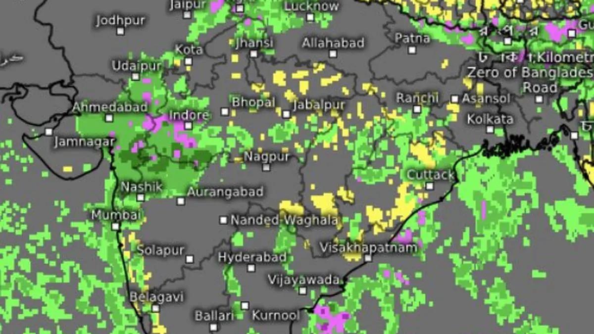
European Centre for Medium-Term Forecasts sees the monsoon active over parts of Gujarat, south-east Rajasthan, west Madhya Pradesh, adjoining west coast, and parts of East India right until September 12.
| Photo Credit:
www.meteologix.com/in
The India Meteorological Department (IMD), in its latest assessment on Wednesday, said the dominant monsoon feature is a well-marked low-pressure area over north-east Madhya Pradesh. The system was expected to weaken by Wednesday evening and move west-north-west across south Uttar Pradesh and north Madhya Pradesh on Thursday. But its weakening need not mean the monsoon itself will weaken.
A broad monsoon trough, the principal conduit for moisture and rainfall, stretched from Bhatinda and Rohtak through Hardoi and Kanpur, and across the centre of the well-marked ‘low,’ to Digha, and onward south-east into the east-central Bay of Bengal. A secondary trough, another marker of a regionally active monsoon regime, extended from north-west Uttar Pradesh to Bangladesh across the low, Jharkhand and West Bengal.
Adding to this configuration was an upper-air cyclonic circulation over north-east Arabian Sea and adjoining Saurashtra. A trough extending from this circulation across south Gujarat and west Madhya Pradesh linked the Arabian Sea side of the weather system with the central Indian ‘low.’ An incoming western disturbance from Pakistan, meanwhile, was crossing into west Gujarat, potentially adding another layer of dynamical support.
Together, they provide enough moisture and atmospheric lift to keep rainf active over large parts of central and eastern India. The immediate outlook, therefore, is less about an abrupt withdrawal than about more spells of rain followed by a region-by-region retreat. The crucial test will come after the Madhya Pradesh ‘low’ weakens.
If the monsoon trough shifts south-east and dry continental air begins to establish itself over Rajasthan and North-West India, withdrawal could gather pace. But the opposite scenario remains possible. Because, if the trough stays anchored over north India or a fresh ‘low’ develops over the Bay, the retreat may not begin anytime soon. The normal date for the onset of monsoon withdrawal isSeptember 17.
IMD’s numerical model projections offer an additional reason for caution. After weakening, the present ‘low’ could be steered in the opposite direction by invading westerlies and eventually settle near Odisha-West Bengal coast. At the same time, the western disturbance could intensify into a ‘low’ by itself over south-west Rajasthan. That would be significant because it would replace the seasonal anticyclone, a high-pressure circulation associated with onset of withdrawal. This would be an unlikely backdrop for an early retreat.
The watch, therefore, shifts to North-West India. Forecasters will be looking for the monsoon trough to pull away towards the south-east after the Madhya Pradesh system dissipates, or for it to remain entrenched across north India. A fresh Bay ‘low’ would strengthen the case for persistence.
On the Arabian Sea side, the staying power of the latest circulation will be equally important. If it continues to funnel moisture into west and Central India, rainfall could remain active even as the calendar advances into September. The clearest evidence of withdrawal would instead be the establishment of dry continental air and anticyclonic circulation over Rajasthan, Punjab, Haryana and adjoining areas, accompanied by a substantial and sustained decline in rainfall over north-west India. A brief lull between weather systems may not qualify.
Copyright© 2026, THG PUBLISHING PVT LTD. or its affiliated companies. All rights reserved.
Comments have to be in English, and in full sentences. They cannot be abusive or personal. Please abide by our community guidelines for posting your comments.
We have migrated to a new commenting platform. If you are already a registered user of TheHindu Businessline and logged in, you may continue to engage with our articles. If you do not have an account please register and login to post comments. Users can access their older comments by logging into their accounts on Vuukle.
Source: Read the original article on www.thehindubusinessline.com