Published: 22:00 BST, 27 August 2026 | Updated: 03:35 BST, 28 August 2026
A powerful new tropical storm has formed in the Pacific, and prediction models fear the cyclone will spiral straight into the heavily populated region of Southern California.
Tropical Storm Karina erupted Thursday afternoon with thunderstorms and sustained winds of more than 45 mph. The National Hurricane Center (NHC) added that they expect the storm to become a hurricane by Friday night.
Although NHC said in their initial forecast that the storm will likely stay well offshore as it grows near the coast of Mexico, new weather models warn that Karina will turn towards the US West Coast within days.
Spaghetti models, which track all possible paths of tropical storms and hurricanes, show multiple tracks where the storm spins east and lands a direct hit somewhere between San Diego and Los Angeles.
NHC expects that the storm's effects, which stretch outward more than 200 miles already, will begin to impact southwest Mexico and the Baja California Peninsula this weekend, bringing rough surf and the potential for dangerous rip currents to the coast.
California has never seen a hurricane make landfall in its recorded history, according to the National Weather Service.
The last time the state was struck by a tropical storm was in 1997 when a weakening Hurricane Nora crossed from Mexico into the US still at tropical storm strength.
Current projections from the American model, known as GFS, show at least six different paths Karina may take which could result in the storm slamming into the California Coast as it barrels through the Pacific.
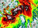
Tropical Storm Karina (Seen on radar) officially developed on August 27, 2026
Weather models predict that Tropical Storm Karina may turn towards Southern California, potentially hitting San Diego or Los Angeles
A tropical storm has not taken such a path, from the ocean straight into Southern California, in nearly a century, when the Long Beach Tropical Storm landed in 1939.
Not all forecasting models agree with early tracks from the GFS model, including the so-called European model, also known as the EPS Ensemble. That system currently has Karina staying away from the California Coast and moving out to sea.
It is important to note that forecast models can shift dramatically once storms form and get closer to making landfall. The farther into the future a forecast model tries to predict, the weaker the certainty of it being correct gets.
Tropical Storm Karina is currently 1,500 miles south of San Diego and NHC believes Karina will remain at hurricane strength through next Tuesday. It is not known if the storm will strengthen into a major hurricane, meaning Category 3 and sustained winds of 111 mph or higher.