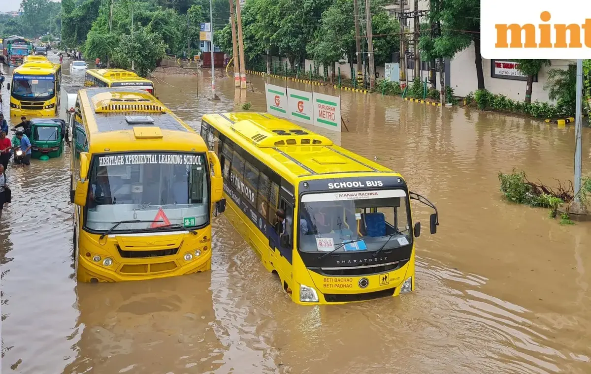
New Delhi: Several parts of Uttar Pradesh and Madhya Pradesh, as well as eastern and northeastern India, are likely to receive heavy rainfall, with many areas at risk of flash floods.
A low-pressure area over south Uttar Pradesh and adjoining northeast Madhya Pradesh is likely to trigger heavy rainfall across parts of northern and central India, with the India Meteorological Department (IMD) warning of isolated extremely heavy rainfall over southwest Uttar Pradesh and northwest Madhya Pradesh.
The weather system is expected to bring fairly widespread rainfall over east Uttar Pradesh on 27 August. West Madhya Pradesh is likely to receive widespread rainfall on 27 August, while Chhattisgarh and east Madhya Pradesh are expected to see such rainfall through 1 September.
The IMD has also flagged a low to moderate flash flood risk over several watersheds and adjoining areas in east Rajasthan, west Uttar Pradesh and west Madhya Pradesh during the next 24 hours.
Bharatpur, Dholpur and Karauli districts in east Rajasthan may face flash flood risk. In west Uttar Pradesh, districts including Agra, Aligarh, Auraiya, Badaun, Etah, Firozabad, Hamirpur, Jhansi, Kasganj, Mainpuri, Mathura and Shahjahanpur are at risk. In west Madhya Pradesh, the areas of concern include Bhind, Datia, Gwalior, Morena and Shivpuri.
The weather office cautioned that surface runoff and inundation could occur in fully saturated soils and low-lying areas following the expected rainfall.
Rainfall activity is expected to remain strong across parts of northwest and central India over the coming week, with the IMD forecasting fairly widespread showers in several states.
In northwest India, Uttarakhand is likely to receive fairly widespread rainfall from 27 August to 1 September. The IMD has forecast fairly widespread rainfall over Himachal Pradesh and Jammu and Kashmir, Ladakh, Gilgit-Baltistan and Muzaffarabad during 31 August-1 September. Other parts of northwest India are likely to receive isolated to scattered rainfall during the period.
Vidarbha is likely to see fairly widespread to widespread rainfall on 27 August, with another spell expected on 31 August-1 September. Rainfall activity over west Madhya Pradesh is expected to become isolated to scattered from 28 August to 1 September, while Vidarbha may witness isolated to scattered showers during 28-30 August.
Rainfall activity is expected to remain subdued over peninsular India during the next week. However, isolated to scattered rainfall is likely across coastal Andhra Pradesh, Telangana, Karnataka, Rayalaseema, Tamil Nadu and Puducherry through 1 September.
Coastal Karnataka is likely to receive fairly widespread rainfall during 26 August-1 September, while Kerala and Lakshadweep are expected to see such rainfall during 26-28 August.
In eastern India, widespread rainfall is likely over Odisha, Jharkhand, Gangetic West Bengal, sub-Himalayan West Bengal and Sikkim through 1 September. Bihar is likely to receive widespread rainfall on 27 August and again on 29 August.
Northeast India is also expected to remain wet, with Arunachal Pradesh likely to receive widespread rainfall through 1 September. Assam and Meghalaya are expected to see increased rainfall from 28 August, while Nagaland, Manipur, Mizoram and Tripura are likely to receive widespread rainfall from 27 August.
The intensity of rainfall was evident in the past 24 hours, with extremely heavy rainfall of 21 cm or more recorded over west Uttar Pradesh. Very heavy rainfall of 12-20 cm was reported from east Uttar Pradesh, east Madhya Pradesh, Arunachal Pradesh and coastal Karnataka. Heavy rainfall of 7-11 cm was recorded in Haryana, Himachal Pradesh, east Rajasthan, Bihar, west Madhya Pradesh, West Bengal and Kerala.
The country received 577.8 mm of cumulative rainfall between 1 June and 25 August, against the normal of 664.7 mm, marking a 13% deficit.