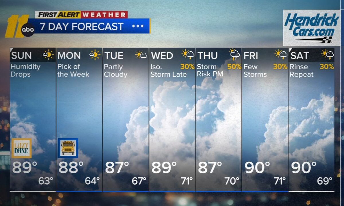
Plenty of sunshine is expected today with seasonable temperatures across central North Carolina.
A weak cold front will move through around midday, bringing in slightly less humid air. No rain is expected with the front.
That front will stall near the coast tomorrow. A few high-resolution models suggest isolated showers or storms could develop south and east of the I-95 corridor, but most of central North Carolina should remain dry and pleasant with a mix of sun and clouds.
An additional shot of drier air arrives Tuesday, with dew points dropping into the low to mid-50s! That should make for a fantastic late-summer day!
Humidity begins to increase again on Wednesday, and a few storms may develop during the evening hours. The best chance for more widespread showers and thunderstorms this week looks to arrive on Thursday.